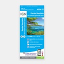
These highly accurate topographic maps contain all the details existing on the terrain, marked trails and tourist information.
The essential hiking map IGN 4254ET. With very high precision, it contains all the existing details on the terrain: communication routes down to the smallest path, buildings including barns, woods, isolated trees, rivers, springs...
Not forgetting the representation of relief through contour lines. Marked trails and tourist information are also shown.
Municipalities covered : Serriera, Galéria, Cristinacce, Manso, Ota, Marignana, Évisa, Renno, Partinello, Osani, Piana
Places to discover : Corse,Golfe de Girolata, Golfe de Porto, Forêt de Tetti, Forêt Territoriale d'Aitone, Forêt Communale du Filosorma, Forêt du Perticatu, Forêt Territoriale du Fango,Capu Rossu, Punta Palazzu, Punta a Scopa, Cap Seninu, Capu Tondu, Punta Validori, Punta Bianca, Punta Muchillina, Isola di Gargalu, Paglia Orba, Col de Palmarella, Bocca a Croce, Capu Tafunatu, Capu Licchia, Col de Sevi, Gorges de Spelunca, Punta Muvrare,Château de Crans, Abbaye de Bonmont, Château, Cabane du Carroz, Sapins de Borsattaz, Saut du Day, Grotte de Réclère, Cabane les Pralets, Cabane Rochefort, Signal de Roche d'Or, Cabane Trois Chalets, Chalet de la Dent de Vaution, Résurgence de l'Orbe
Main features





 15.80 €
15.80 €
15.80 €