These highly accurate topographic maps contain all existing terrain details, marked trails, and tourist information.
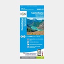
The essential IGN 3542OT hiking map. With very high precision, it contains all existing terrain details: communication routes down to the smallest path, constructions including barns, woodland, isolated trees, rivers, springs...
Not to mention the relief representation through contour lines. Marked trails and tourist information are also shown.
Municipalities covered: Le Bourguet, Rougon, Valderoure, Ubraye, Séranon, La Bastide, Demandolx, Châteauvieux, La Garde, Brenon, Saint-Julien-du-Gorges du Verdon, Vergons, Angles, Peyroules, La Martre, Castellane, Soleilhas, Val-de-Chalvagne, Saint-Auban, Caille, Briançonnet
Places to discover: Gorges du Verdon, Préalpes d'Azur, Lac de Castillon, Montagne de Bleine, Destourbes, Clue de St-Auban, Crête de la Bernarde, Montagne de l'Aup, Sommet de Pré Chauvin, Montagne de Brouis, Montagne de Lachens, Montagne de l'Audibergue, Mgne de Robion, Beysse, Col de Toutes Aures, Crête du Teillon
Main features






 15.80 €
15.80 €
15.80 €